
blah blah blah
Mts. Mack and Klem
Length: 6.1 miles out-and-back with loopDifficulty (click for info): Moderate
Elevation Gain: 1100 feet
Rating (click for info): 7/10
Elevation: 1945' (Mack) and 2001' (Klem)
Prominence: 175' (Mack) and 471' (Klem)
Driving Directions:
Trailhead and parking area are off Wood Road in Gilford, NH. To get there, take Bickford Road from Rt. 11A, 4.4 miles southeast of Rt. 11B and 2.7 miles west of Rt. 11. Heading east, Bickford road is the first right after the Gunstock Mountain Ski Area entrance. Drive 0.2 miles down Bickford Road, then turn left onto Wood Road. Continue for less than 0.1 miles; the road then ends at a house. Just before the driveway, turn left onto an unnamed road with a sign for trail parking. This road ends in a short distance at a parking area with spaces for five cars.
About the Hike:
Mt. Mack and Mt. Klem are two small mountains in the center of the Belknap Range. Mack has two good viewpoints to the south and west, while Klem bears a fine viewpoint to the north and west. The hike to them passes Round Pond, a picturesque lake on a plateau below the two.
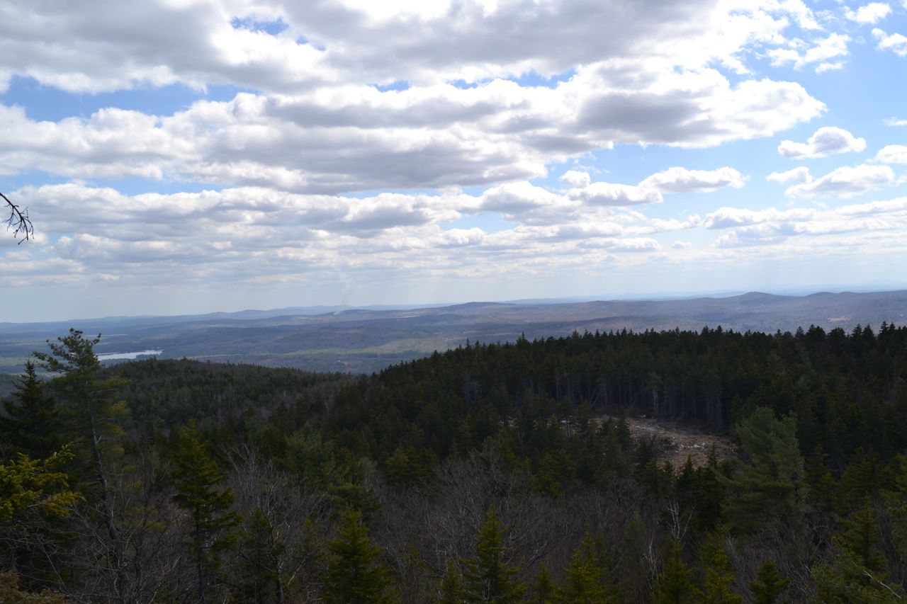
The hike begins on the East Gilford Trail. This path descends past a gate and crosses a bridge over a rushing brook. Just past this, continue straight onto a logging road (East Gilford Fire Road) as the trail turns right. The logging road begins to climb moderately and becomes rocky. It passes a logging landing at the top of a hill and then swings into the forest. It flattens out and leads along the hillside, where more logging has opened up a limited viewpoint toward nearby Belknap and Gunstock Mountains. You can also glimpse Mt. Moosilauke and part of the Sandwich Range. The path continues gradually uphill and soon ends at Round Pond Trail, 0.7 miles from its beginning. Turn left onto this wide multi-use trail, which begins to climb and becomes rocky again. After a long section of straight trail, the path narrows and winds through the forest. 0.7 miles from the logging road, Round Pond-Piper Link joins the trail from the right and they descend 0.1 miles to the northwest shore of Round Pond. Mt. Mack rises directly across the lake, and Mt. Klem is seen off to the left.
Round Pond Trail ends here, while Round Pond-Piper Link turns to the left (this is only indicated by a change of blaze color - red to green). Continue on this trail as it swings away from the pond to go around the marshy north end. It then joins a woods road and returns to the pond. A spur leads downhill to the water's edge, then the main trail also emerges along the shore. Further along the trail is a viewpoint of Belknap Mountain over the water. The best viewpoints end here and the trail again leaves the pond.
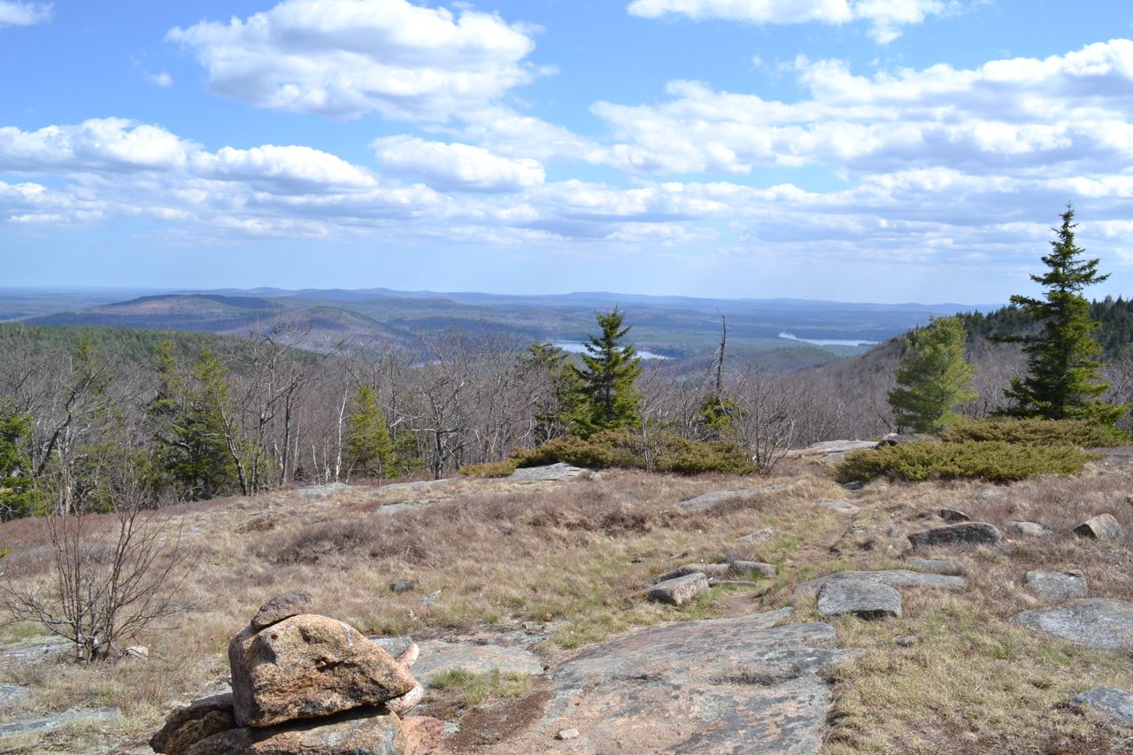
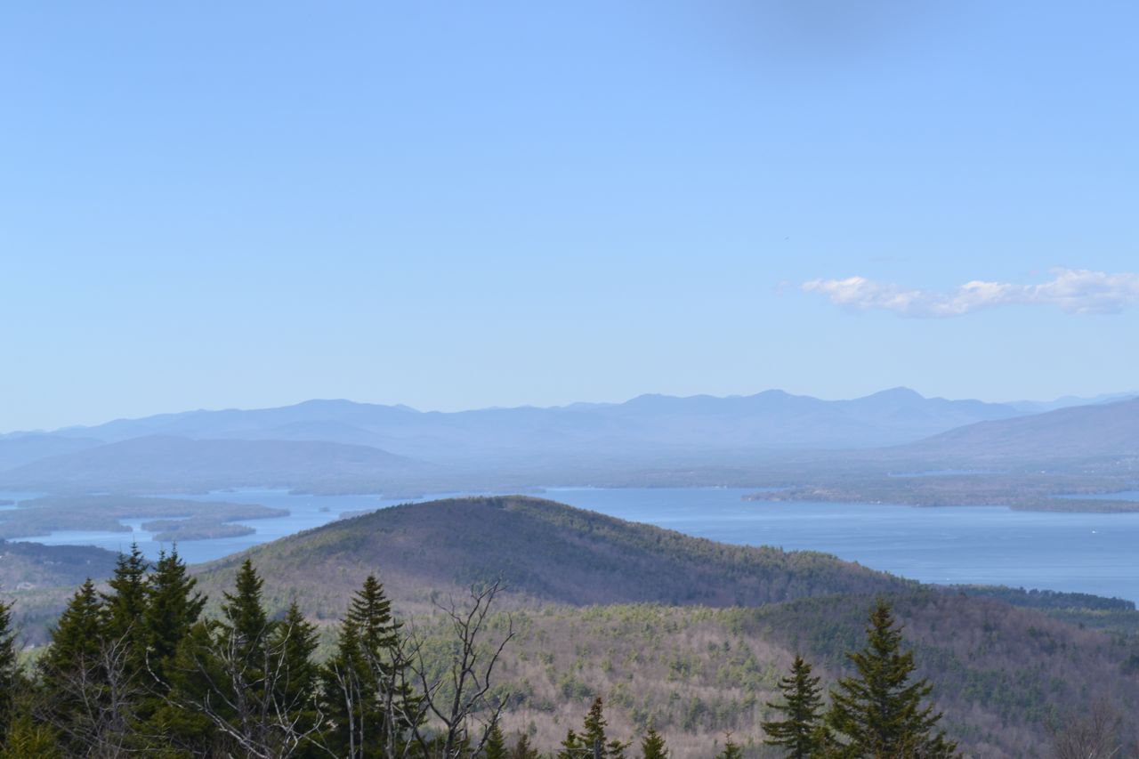
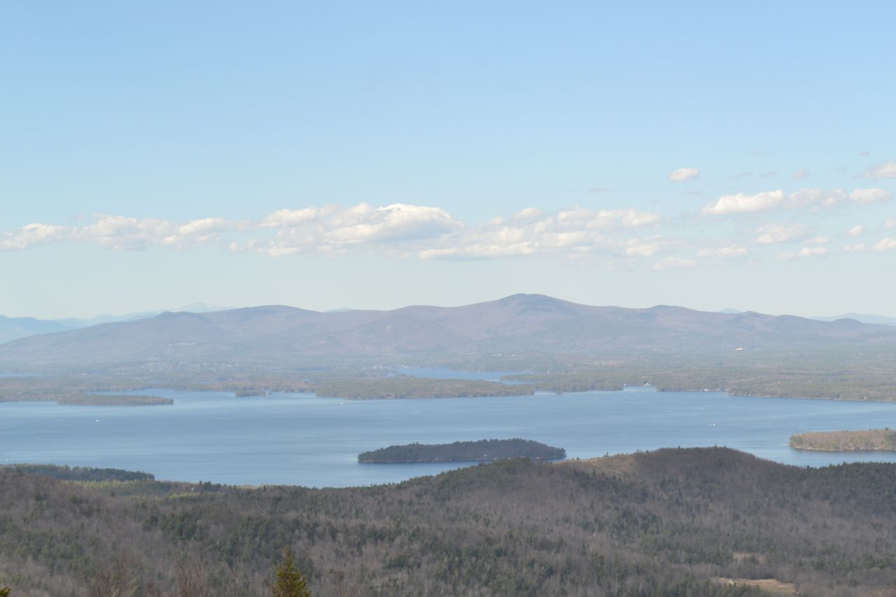
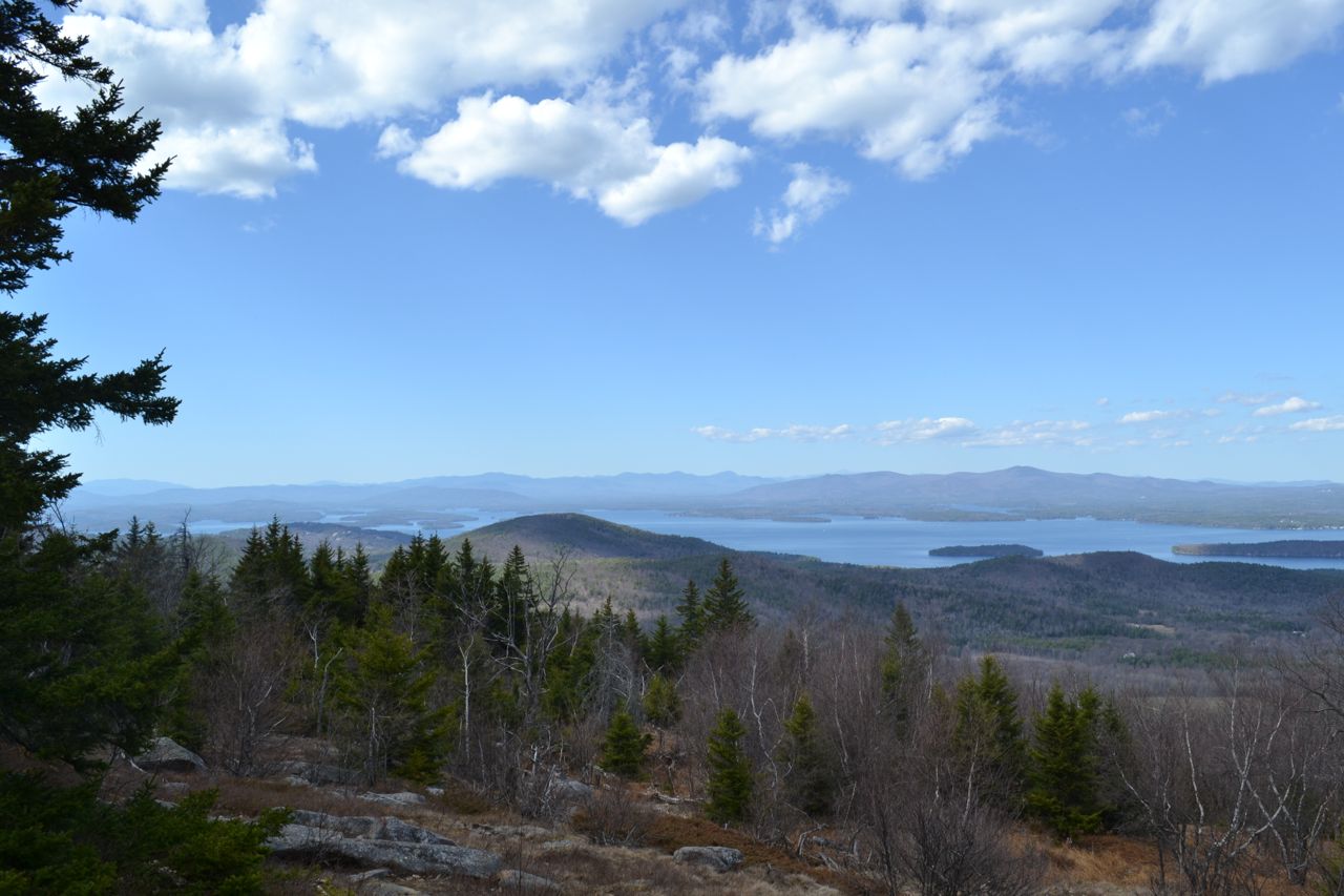
In 0.3 miles from the first viewpoint over the pond, reach a junction with Mount Klem-Mount Mack Loop on the left (this is where you will end the loop over the mountains). Continue straight onto Round Pond-Mount Mack Trail (blazes change to red) and go 0.1 miles to a camp clearing. Turn left onto Mack Ridge Trail (no sign, look for orange blazes). The path becomes narrower and less traveled. It passes a few wet areas, then climbs past two logging roads and landings. It then comes out onto Round Pond-Mount Mack Trail; turn left onto this trail. It climbs steeply 0.3 miles to a cleared viewpoint to the west. From here, you look out to the western Belknap Range: Whiteface, Piper, Belknap, and Gunstock Mountains. You can also see Mt. Kearsarge to the southwest and Mt. Moosilauke to the northwest. The trail then moderates and climbs to a ledge with a wide view to the south. The summit, topped with two communications towers, is reached shortly after that. Bear left onto Mount Klem-Mount Mack Loop. The trail descends easily for 0.4 miles, then begins to climb Mt. Klem. On the way, it crosses a grassy ledge with views toward the Eastern Belknap Range: Rand, Quarry, and Straightback Mountains and Mt. Major. The ascent ends in 0.3 miles at a trail junction near the summit. Here, a white spur trail leads 0.1 miles to the left to the viewless summit of Mt. Klem. If you are trying to earn the Belknap Range Hiker patch, you will need to turn left here and follow the white blazes 0.1 miles to the summit of Mt. Klem. You will probably also want to visit Rand Mountain, most easily accessed from here. Continue straight on the loop trail for 0.1 miles to a superb northern viewpoint over Lake Winnipesaukee. Mt. Moosilauke and the Kinsman Range are seen to the northwest, the Sandwich Range to the north, and the Ossipees to the northeast. Mt. Washington and the southern Presidentials can be seen over the Ossipees. Several other high mountains can be seen peering over ridges. To complete the loop, continue on the trail for 0.9 miles as it descends moderately over a few ledges back to the trail junction at Round Pond.
Printable directions page